

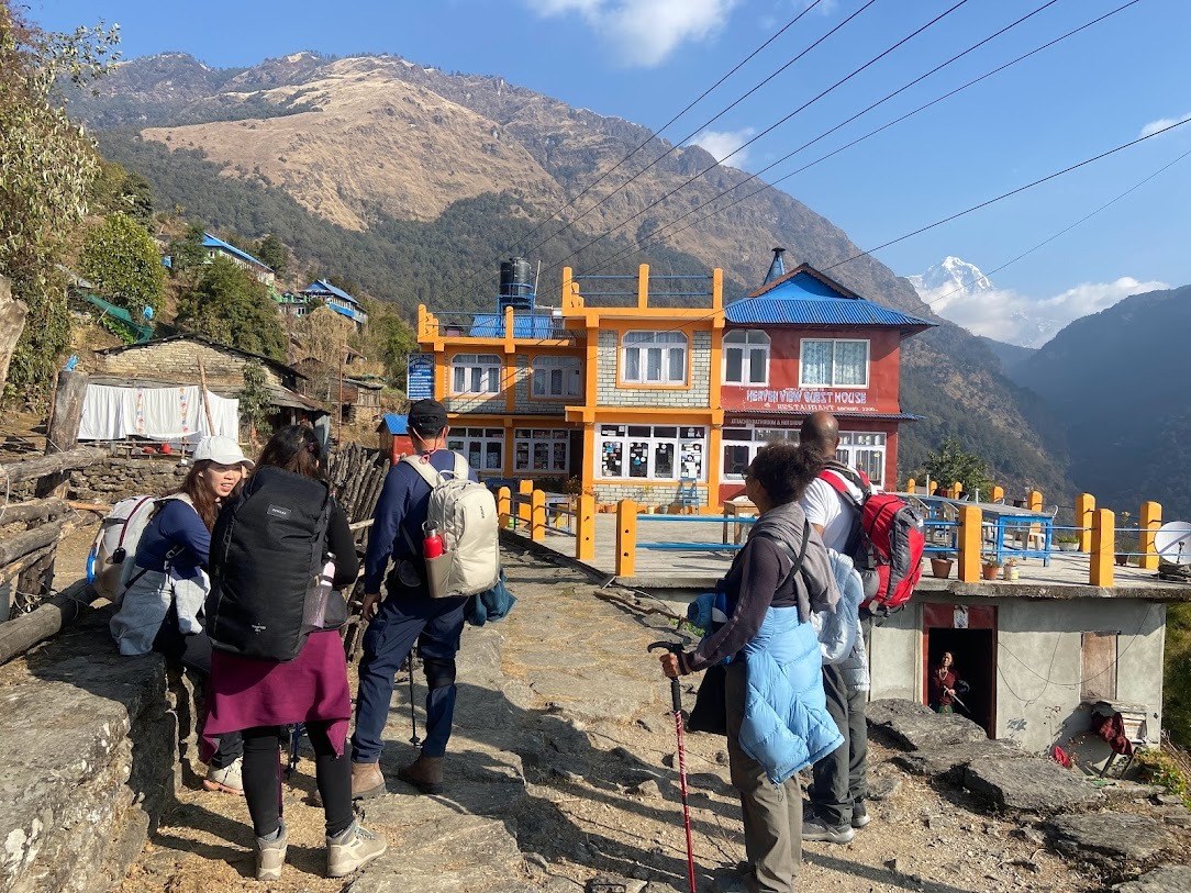
The Annapurna region is home to some of Nepal's most varied mountain viewpoints, ranging from easy-to-reach village viewpoints to high-altitude destinations surrounded by glaciers and snow-covered peaks. You can enjoy Himalayan scenery from a short trek to Ghandruk or Poon Hill, while longer routes take you toward Mardi Himal, Annapurna Base Camp, Tilicho Lake, and Thorong La.
What makes the Annapurna region particularly appealing is the variety of perspectives. Poon Hill gives a wide sunrise panorama, Mardi Himal brings you closer to Machapuchare, Ghandruk combines mountain scenery with Gurung culture, and Annapurna Base Camp places you inside a natural mountain amphitheater. Higher destinations such as Tilicho Lake and Thorong La provide a more rugged alpine landscape.
Whether you are looking for a sunrise viewpoint, a photography destination, a quieter trekking route, or a challenging high-altitude adventure, the right viewpoint depends on your available time, trekking experience, and the type of scenery you want to experience.
Why Are There So Many Great Viewpoints in the Annapurna Region?
The Annapurna region covers a wide range of landscapes and elevations, so the scenery changes significantly from one trail to another. Lower routes pass through forests, terraced farmland, and traditional villages, while higher trails lead into alpine meadows, rocky valleys, glaciers, and snow-covered mountain terrain.
The Annapurna massif includes major peaks such as Annapurna I, Annapurna South, Annapurna III, Annapurna IV, Machapuchare, Hiunchuli, and Gangapurna. The mountains appear from different angles depending on the trail, which is why a sunrise from Poon Hill feels very different from standing inside the Annapurna Sanctuary at ABC.
Many viewpoints are also part of established trekking routes. The journey to the viewpoint can therefore be as important as the viewpoint itself, taking you through Gurung and Magar villages, rhododendron forests, suspension bridges, waterfalls, high-altitude settlements, and changing mountain landscapes.
Best Viewpoints in the Annapurna Region
Poon Hill
Altitude: 3,210 meters / 10,531 feet
Poon Hill is one of the most popular sunrise viewpoints in the Annapurna region and is known for its wide panorama of the Annapurna and Dhaulagiri ranges. Trekkers normally leave Ghorepani before sunrise and follow the stone steps toward the viewpoint while it is still dark. As daylight reaches the mountains, the surrounding peaks gradually become visible and the changing light creates different colours across the Himalayan skyline.
From Poon Hill, clear-weather views can include Annapurna I, Annapurna South, Annapurna III, Dhaulagiri, Machapuchare, Hiunchuli, and other surrounding peaks. The viewpoint is also accessible without spending several days at extreme altitude, making it suitable for travellers who want a classic Himalayan panorama on a relatively short trek. The surrounding Ghorepani and Ghandruk route adds forests, villages, terraced hills, and traditional mountain landscapes to the experience.
Best for: Sunrise, panoramic mountain views, short trekking holidays, and first-time trekkers.
Route: The popular route passes through Tikhedhunga, Ulleri, Banthanti, and Ghorepani before reaching Poon Hill.
Mardi Himal Viewpoint
Altitude: Around 4,500 meters / 14,763 feet
Mardi Himal is known for its close views of Machapuchare, the distinctive Fishtail Mountain that dominates the skyline above the surrounding valleys. The trail gradually climbs from lower forest sections into rhododendron and pine forests, alpine meadows, and more exposed mountain terrain.
As you approach the upper viewpoints, the landscape opens considerably. Machapuchare becomes particularly prominent, while Annapurna South, Hiunchuli, Mardi Himal, and other surrounding peaks can be seen in clear conditions. The higher sections are more demanding than lower viewpoints such as Ghandruk or Poon Hill because of the altitude, longer walking days, and changing weather.
Mardi Himal is a good option for trekkers who want close mountain scenery while completing a relatively short Himalayan trek. The changing landscape from forest to open ridge also makes the route appealing to photographers.
Best for: Close-up mountain views, Machapuchare scenery, photography, and quieter trekking.
Route: Common approaches include Kande or Phedi, followed by Deurali, Forest Camp, Low Camp, High Camp, and the upper Mardi Himal viewpoint.
Annapurna Base Camp
Altitude: 4,130 meters / 13,550 feet
Annapurna Base Camp offers a different mountain-view experience because the peaks surround the destination from several directions. The area is often described as a natural amphitheater, with steep mountain walls, glaciers, and high Himalayan peaks rising around the sanctuary.
The trek passes through changing landscapes before reaching the higher sections. Lower sections include forests, waterfalls, terraced hills, and villages, while the trail gradually moves into alpine terrain around Machapuchare Base Camp and Annapurna Base Camp.
From ABC, trekkers can see Annapurna I, Annapurna South, Annapurna III, Machapuchare, Hiunchuli, Gangapurna, and surrounding peaks. The enclosed setting makes ABC different from ridge viewpoints such as Poon Hill or Khopra Danda because you are surrounded by the mountains rather than looking toward them from a distance.
Best for: Close mountain scenery, photography, high-altitude trekking, and travellers wanting a deeper Annapurna experience.
Route: A common route passes through Nayapul, Tikhedhunga, Ulleri, Ghorepani, Tadapani, Chomrong, Sinuwa, Bamboo, Deurali, Machapuchare Base Camp, and Annapurna Base Camp.
Tilicho Lake
Altitude: 4,919 meters / 16,138 feet
Tilicho Lake is one of the most distinctive high-altitude destinations in the Annapurna region. The lake lies in a rugged mountain landscape surrounded by rocky slopes, glaciers, and high peaks. Its setting is very different from the green hills and forests found along lower Annapurna routes.
The views around Tilicho Lake include Tilicho Peak, the Nilgiri range, Khangsar Kang, and other Himalayan peaks. The combination of the high-altitude lake, barren alpine terrain, and surrounding mountains makes the area particularly interesting for landscape photography.
Tilicho Lake is normally visited as a side trip from the Annapurna Circuit. The route involves significant altitude gain and uneven terrain, so proper acclimatization is important before attempting the excursion.
Best for: Landscape photography, high-altitude scenery, mountain lakes, and experienced trekkers.
Route: The Tilicho side trip is generally approached from the Manang area through Khangsar and Tilicho Base Camp before continuing toward the lake.
Thorong La Pass
Altitude: 5,416 meters / 17,769 feet
Thorong La is the highest point of the Annapurna Circuit and one of the most dramatic high-altitude viewpoints in the region. The pass connects the Manang side of the circuit with the Mustang side, and the landscape changes noticeably as the trail climbs above the tree line.
The approach becomes increasingly rocky and exposed as you climb toward the pass. Prayer flags at Thorong La contrast with the surrounding mountains and open sky, while the views can extend toward Annapurna, Dhaulagiri, Gangapurna, Tilicho Peak, and other surrounding peaks depending on weather conditions.
Crossing Thorong La requires careful planning because of the altitude, cold temperatures, wind, and changing mountain weather. Trekkers normally start early so that the pass can be crossed before stronger afternoon winds and deteriorating conditions.
Best for: High-altitude adventure, dramatic mountain landscapes, and trekkers completing the Annapurna Circuit.
Muldai Viewpoint
Altitude: Around 3,637 meters / 11,932 feet
Muldai Viewpoint is a lesser-known viewpoint in the Annapurna region that offers a wide Himalayan panorama without the crowds found at some of the more established viewpoints. Located along the Muldai Ridge route near Ghorepani and Dobato, the viewpoint provides open views of the Annapurna and Dhaulagiri ranges, with Machapuchare also visible on clear days.
The viewpoint is particularly attractive around sunrise, when the first light reaches the surrounding peaks and the changing colours create a broad mountain panorama. The trail passes through forests, rhododendron areas, and high ridges, making the journey part of the experience rather than simply a short viewpoint visit.
Muldai can be incorporated into routes around the Ghorepani, Dobato, and Khopra areas. The higher elevation means trekkers should still prepare for colder conditions and changing weather, particularly during winter and early spring.
Best for: Sunrise, panoramic mountain views, quieter trekking, photography, and trekkers looking for an alternative to busier viewpoints.
Khopra Danda
Altitude: 3,660 meters / 12,008 feet
Khopra Danda, also known as Khopra Ridge, is a quieter viewpoint overlooking the mountains and valleys of the Annapurna region. Its position on a high ridge provides broad views toward Dhaulagiri, Annapurna South, Nilgiri, Hiunchuli, and Machapuchare.
The route passes through forests, alpine meadows, and traditional villages before reaching the ridge. Compared with some of the better-known viewpoints in the Annapurna region, Khopra Danda generally provides a quieter trekking environment.
The ridge is particularly attractive around sunrise and sunset, when changing light reaches the surrounding peaks. The route also provides opportunities to experience local village life and smaller mountain lodges away from some of the busier trekking trails.
Best for: Quiet trekking, sunrise and sunset, mountain photography, and travellers looking for a less crowded route.
Ghandruk
Altitude: Around 1,940 meters / 6,365 feet
Ghandruk is a traditional Gurung village and one of the most accessible places in the Annapurna region for combining mountain scenery with local culture. The village sits on a hillside with views toward Annapurna South, Hiunchuli, Machapuchare, and surrounding mountains.
The experience in Ghandruk is not limited to the mountain panorama. Stone houses, narrow village paths, terraced fields, traditional architecture, and Gurung culture are important parts of the visit. Trekkers can explore the village and enjoy mountain views without reaching the high elevations required on routes such as ABC or Thorong La.
Ghandruk is also an important stop on several trekking routes and can be visited on shorter itineraries from Pokhara or combined with longer routes toward Poon Hill and Annapurna Base Camp.
Best for: Beginners, families, cultural experiences, village scenery, and accessible mountain views.
Gangapurna Lake
Altitude: Around 4,700 meters
Gangapurna Lake is a glacial lake near Manang that provides a different type of Himalayan viewpoint. Instead of looking across a mountain range from a high ridge, visitors can observe the lake and surrounding glacial landscape beneath the steep mountain slopes.
Gangapurna and other surrounding peaks dominate the scenery, while the moraine-covered slopes show the effects of the area's glacial environment. The lake can be visited from Manang and is often included as a short excursion during an acclimatization stay. Because the lake is at high elevation, visitors should still take altitude seriously even though the excursion from Manang is relatively short.
Best for: Photography, glacial landscapes, acclimatization walks, and trekkers on the Annapurna Circuit.
Mohare Danda
Altitude: Around 3,300 meters / 10,827 feet
Mohare Danda is a community-based trekking destination known for mountain views and quieter trails. The viewpoint looks toward Dhaulagiri, Annapurna South, Hiunchuli, and Machapuchare, with surrounding hills and valleys adding depth to the landscape.
A distinctive feature of Mohare Danda is its community-based tourism approach. Local communities provide accommodation and services along the route, allowing trekkers to experience local hospitality while supporting villages along the trail.
The viewpoint is particularly attractive around sunrise and sunset, when changing light can highlight the surrounding peaks. It is also suitable for travellers who want mountain scenery away from some of the busier trekking routes.
Best for: Sunrise, community-based tourism, quieter trekking, and responsible travel.
Khumai Danda
Altitude: Around 2,500 meters / 8,202 feet
Khumai Danda is a relatively lower-altitude viewpoint that offers mountain scenery without the elevation of destinations such as Annapurna Base Camp or Thorong La. The route passes through forested landscapes and traditional settlements before reaching the viewpoint.
From Khumai Danda, trekkers can enjoy views toward Machapuchare, Annapurna South, Hiunchuli, and surrounding valleys. During spring, rhododendron forests add colour to the landscape, while the lower altitude makes the route suitable for travellers looking for a shorter mountain experience. The viewpoint can appeal to beginners who want Himalayan scenery without immediately committing to a demanding high-altitude trek.
Best for: Beginners, shorter treks, spring rhododendrons, nature photography, and quieter mountain experiences.
Best Remote Viewpoints in the Annapurna Region
Some of the most distinctive viewpoints in the Annapurna region are found in remote valleys and high Himalayan landscapes away from the busier trekking routes. These places combine mountain scenery with traditional villages, Buddhist culture, pilgrimage sites, and the dry landscapes of Mustang.
Kang La Pass in the Nar Phu Valley and the historic destinations of Muktinath and Lo Manthang each offer a different perspective of the Annapurna region. The access requirements also vary, with Nar Phu and Upper Mustang requiring special permits for their restricted areas.
Kang La Pass (5,322 meters / 17,460 feet)
Kang La Pass is a high mountain pass in the remote Nar Phu Valley of the Annapurna region. At around 5,322 meters, it provides a dramatic viewpoint over the surrounding Himalayan landscape and connects the Nar Phu Valley with the Annapurna Circuit route. The crossing is demanding because of the altitude, steep terrain, and changing mountain weather.
The approach to Kang La takes trekkers through remote valleys, traditional stone villages, Buddhist monasteries, and landscapes that see far fewer visitors than the main Annapurna routes. From the pass, trekkers can see peaks including Annapurna II, Gangapurna, Tilicho Peak, Pisang Peak, and the Chulu range. The Nar Phu Valley itself is part of a restricted area, so the required special permit and trekking arrangements need to be prepared before entering the region.
Highlights
- Remote mountain landscape of the Nar Phu Valley
- High-altitude viewpoint at Kang La Pass
- Views of Annapurna II, Gangapurna, Tilicho Peak and Chulu peaks
- Traditional villages and Buddhist monasteries
- Rugged landscapes away from the main trekking routes
- Challenging pass crossing for experienced trekkers
Route: The Nar Phu route generally follows Besisahar, Dharapani, Koto, Meta, Phu Village, and Nar Village before crossing Kang La Pass and descending toward Ngawal on the Annapurna Circuit.
Muktinath (3,710 meters / 12,172 feet)
Muktinath is one of the best-known cultural and pilgrimage destinations in the Annapurna region, located on the Mustang side of the Annapurna Circuit. At 3,710 meters, the area provides views across the dry Himalayan landscape and surrounding peaks. Its location also makes it an important point between the higher Manang section of the circuit and the Kali Gandaki Valley.
Muktinath is sacred to both Hindus and Buddhists. The temple area is known for its 108 water spouts and natural gas flame, while the surrounding landscape shows the transition from the greener valleys of central Annapurna to the drier terrain of Mustang. Travellers can reach Muktinath by trekking across Thorong La or by road through the Kali Gandaki Valley, making it accessible through several types of Annapurna and Mustang itineraries.
Highlights
- Important Hindu and Buddhist pilgrimage site
- Mountain views across the Mustang landscape
- 108 sacred water spouts
- Natural gas flame at the temple complex
- Traditional villages and landscapes of the Kali Gandaki Valley
- Cultural and natural attractions in one destination
Route: Muktinath can be reached on the Annapurna Circuit after crossing Thorong La Pass, or by road from Jomsom through Kagbeni. It can also be included in Mustang-focused tours.
Lo Manthang (3,840 meters / 12,598 feet)
Lo Manthang is a historic walled settlement in Upper Mustang, surrounded by the dry valleys, cliffs, and high-desert landscapes of northern Mustang. At 3,840 meters, the scenery is very different from the green hills and forested viewpoints found in the lower Annapurna region. The surrounding terrain provides wide views across the trans-Himalayan landscape.
The journey to Lo Manthang also introduces trekkers to the distinctive Tibetan-influenced culture of Upper Mustang. Traditional mud-and-stone houses, monasteries, chortens, caves, and the historic walled settlement are important parts of the experience. Upper Mustang is a restricted area, so travellers need the required special permits and must follow the applicable entry requirements.
Highlights
- Historic walled settlement of Lo Manthang
- High-altitude desert landscape of Upper Mustang
- Tibetan-influenced culture and traditional architecture
- Ancient monasteries, chortens, and caves
- Wide views across the Mustang landscape
- Remote trekking experience away from the main Annapurna trails
Route: The traditional route to Lo Manthang begins from Jomsom and continues through Kagbeni, Chele, Ghami, Tsarang, and other Mustang villages before reaching the walled city.
Best Viewpoints by Type
The right viewpoint depends on what kind of experience you want. The Annapurna region has everything from accessible village viewpoints to high-altitude mountain destinations, so your choice should depend on your available time, trekking experience, preferred scenery, and tolerance for altitude.
Best for Sunrise
Poon Hill is one of the most established sunrise viewpoints in the Annapurna region. Its position above Ghorepani provides a wide view toward the Annapurna and Dhaulagiri ranges, and the early climb allows trekkers to reach the viewpoint before sunrise. Mohare Danda is another option for travellers who want sunrise views on a quieter community-based route.
Best for Beginners
Ghandruk and Khumai Danda are suitable options for beginners who want mountain scenery without immediately taking on a high-altitude route. Ghandruk combines accessible mountain views with Gurung culture and village life, while Khumai Danda offers a lower-altitude trail through forests and local settlements.
The choice should still depend on your walking experience, fitness, available time, and current trail conditions rather than altitude alone.
Best for Photography
Annapurna Base Camp, Tilicho Lake, Poon Hill, and Mardi Himal offer different photography opportunities. ABC places you inside a mountain amphitheater, Tilicho Lake combines a high-altitude lake with rugged alpine terrain, Poon Hill provides a broad sunrise panorama, and Mardi Himal offers close views of Machapuchare from the upper sections.
Best for Off-the-Beaten-Path Trekking
Khopra Danda and Mohare Danda are useful choices for travellers who prefer quieter trails and a stronger connection with local communities. Khopra Danda provides broad mountain views from a high ridge, while Mohare Danda follows a community-based trekking route. Khumai Danda is another option for a shorter and quieter mountain experience.
Best for High-Altitude Adventure
For travellers looking for a more demanding mountain experience, Thorong La and Tilicho Lake offer high-altitude landscapes that require proper preparation and acclimatization. Thorong La reaches 5,416 meters and involves crossing a high mountain pass, while Tilicho Lake sits at 4,919 meters in a remote alpine setting.
Best for Mountain and Culture
Ghandruk is particularly suitable if you want to combine Himalayan views with local culture. The village provides views of major Annapurna peaks while also offering an opportunity to experience Gurung architecture, traditional houses, terraced fields, local food, and village life.
Best Time to Visit Annapurna Region Viewpoints in Nepal
The best time to visit an Annapurna viewpoint depends on the route, elevation, and weather conditions. Spring and autumn are the main trekking seasons in the region, with generally favourable conditions for trekking and mountain visibility. Nepal Tourism Board also lists March to May and September to November as the main seasons for the Annapurna Conservation Area.
Spring: March to May
Spring is a good season for trekking in the Annapurna region. Temperatures become more comfortable as winter ends, while rhododendron forests across the lower and middle elevations begin to bloom. The colourful forests add another attraction to viewpoints such as Poon Hill, Mohare Danda, Khumai Danda, and Mardi Himal.
Clear mornings can provide good mountain views, particularly from sunrise viewpoints. Higher routes can still be cold, so trekkers heading toward Tilicho Lake, Annapurna Base Camp, or other high destinations should prepare for changing conditions.
Autumn: September to November
Autumn is one of the most popular periods for trekking in the Annapurna region. After the main monsoon period, the atmosphere often becomes clearer, creating good opportunities to see distant mountain ranges.
September, October, and November are particularly popular for routes such as the Annapurna Circuit, Annapurna Base Camp, Mardi Himal, and Poon Hill. Higher destinations such as Thorong La still require careful weather monitoring because conditions can change quickly at altitude.
Winter: December to February
Winter can provide clear mountain views, but temperatures drop significantly at higher elevations. Snow can affect high trails and mountain passes, particularly around Thorong La and other exposed sections.
Lower viewpoints such as Ghandruk and some shorter routes can remain accessible depending on current conditions. Anyone planning a high-altitude viewpoint in winter should check the weather and trail conditions before departure and carry suitable cold-weather equipment.
Monsoon: June to August
The monsoon brings frequent rainfall to much of the Annapurna region. Lower trails can become wet and slippery, while clouds can obscure mountain views. Leeches can also be present on forested trails during periods of heavy rain.
The northern parts of the Annapurna region, including areas around Manang and Mustang, can experience drier conditions because of the rain-shadow effect. This does not mean every route is automatically suitable during monsoon, so current weather and trail conditions should still be checked before travelling.
Overall, spring and autumn are generally the most practical seasons for clear mountain views and comfortable trekking conditions, while winter and monsoon require more careful route and weather planning.
Packing List for Annapurna Viewpoint Treks
The equipment you need depends on the altitude, season, and length of your trek. A short trip to Ghandruk requires less equipment than a high-altitude trek toward Tilicho Lake or Thorong La, but basic protection from sun, cold, rain, and changing mountain weather is important on every route.
- Comfortable, sturdy trekking boots with good grip
- Lightweight shoes or sandals for use at teahouses
- Warm fleece or insulated jacket
- Breathable base-layer T-shirts
- Windproof or waterproof trekking jacket
- Warm hat, sun hat, or cap
- Sunglasses with UV protection
- Sunscreen and lip balm with sun protection
- Reusable water bottle
- Water purification tablets or another suitable purification method
- Energy bars, chocolate, or other light snacks
- Small daypack for viewpoint hikes
- Trekking poles for steep or uneven trails
- Crampons if required by the season and route conditions
- Personal medicines and a basic first-aid kit
- Pulse oximeter for higher-altitude trekking if recommended by your trekking team
- Power bank and appropriate charging accessories
- Copies of passport, permits, insurance documents, and other travel paperwork
- Camera or phone for photography
- Sufficient Nepalese rupees for remote sections where card payment may not be available
For high-altitude routes, adjust your packing list according to the season and current trail conditions. Equipment suitable for Poon Hill may not be sufficient for Thorong La or Tilicho Lake, particularly during colder months or periods of snow.
Safety Tips for Annapurna Viewpoints
Check Permits Before Trekking
Make sure you have the permits and documents required for your particular Annapurna route before starting the trek. Requirements can differ depending on the route and protected area. Current Nepal Tourism Board guidance also identifies several Annapurna routes, including Annapurna Circuit, Poon Hill-ABC, Khopra, and Mardi Himal, under the guide and TIMS requirements.
Keep your documents accessible during the trek because checkpoints may require you to show them.
Take Altitude Seriously
Altitude becomes increasingly important as you move above 2,500 meters. Do not rush toward a high viewpoint simply because you feel fine at a lower elevation. Give your body time to adjust, stay hydrated, and pay attention to symptoms such as headache, nausea, dizziness, unusual fatigue, or difficulty breathing.
If symptoms become serious or worsen, descending to a lower altitude is an important part of managing altitude-related illness. High viewpoints such as Tilicho Lake and Thorong La require considerably more attention to acclimatization than lower destinations such as Ghandruk.
Check the Weather
Mountain weather can change quickly. A clear morning can turn cloudy, windy, rainy, or snowy within a short period, particularly at higher elevations. Check the weather before leaving for a viewpoint and be prepared to change your plans if conditions become unsafe.
Use a Local Guide Where Appropriate
A local guide can provide practical knowledge about the trail, weather, accommodation, altitude, and local conditions. This is particularly useful on less-travelled routes and high-altitude sections where trail conditions can change.
Current Nepal Tourism Board guidance also requires licensed guides and agency-issued TIMS cards on several Annapurna routes, so trekkers should check the current requirements before departure.
Carry Warm and Waterproof Layers
Do not judge mountain weather from the temperature in Pokhara or at a lower village. Conditions can become considerably colder as you gain elevation. Carry a warm layer and waterproof protection even when the weather looks good at the beginning of the day.
Be Careful on Wet and Snowy Trails
Stone steps, forest trails, rocks, and exposed sections can become slippery during rain or snow. Good trekking footwear and trekking poles can provide additional stability. On high-altitude routes, check whether additional equipment such as microspikes or crampons is appropriate for current conditions.
Carry Basic First Aid
A basic first-aid kit is useful for minor cuts, blisters, headaches, and other common trekking problems. For higher routes, discuss altitude-related medication with a qualified medical professional before travelling rather than relying on self-treatment.
Avoid Unnecessary Solo Travel on Remote Routes
Remote viewpoints such as Khopra Danda, Mohare Danda, and high-altitude side trips can involve long stretches away from major settlements. Travelling with a guide or trekking companion provides additional support if you encounter an injury, sudden weather change, or navigation problem.
Respect Local Communities and the Environment
Many Annapurna viewpoints pass through villages and environmentally sensitive areas. Respect local customs, avoid unnecessary disturbance, carry your waste with you, and use designated accommodation and trails. Responsible trekking helps protect the mountain environment and supports the communities along the route.
Get Appropriate Travel Insurance
Travel insurance should cover the activities and elevations included in your itinerary. If your trek involves high-altitude routes, check the policy carefully for trekking limits, emergency medical treatment, and helicopter evacuation. Rescue and evacuation costs can be substantial without appropriate coverage.
Plan Your Annapurna Viewpoint Trek
The right Annapurna viewpoint depends on the experience you want and how much time you have available. Poon Hill suits travellers interested in sunrise, Ghandruk combines mountain scenery with Gurung culture, Mardi Himal brings you closer to Machapuchare, and Khopra Danda and Mohare Danda provide quieter alternatives. For a deeper high-altitude experience, Annapurna Base Camp, Tilicho Lake, and Thorong La take you further into the Himalayan landscape.
You can also combine viewpoints within a longer itinerary rather than visiting only one destination. Poon Hill can be incorporated into an Annapurna Base Camp itinerary, while Tilicho Lake can be added to an Annapurna Circuit itinerary depending on the route and available time.
If you are planning an Annapurna trek and are unsure which viewpoint or itinerary matches your time, trekking experience, and preferred scenery, Nepal Himalayas Trekking can help you plan the route and arrange the necessary trekking services.
Explore our Annapurna trekking packages and start planning your Himalayan journey with Nepal Himalayas Trekking.








Add Your Comment