

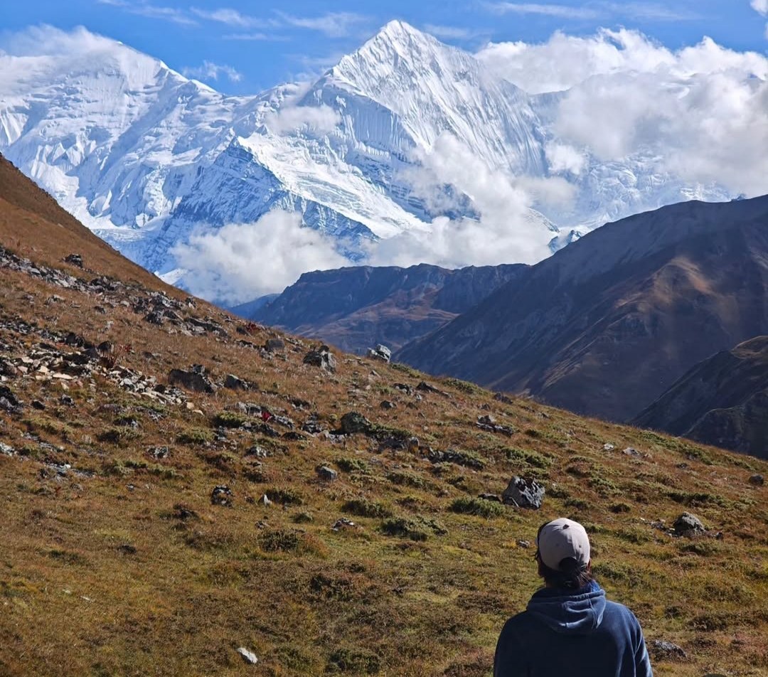
The Thorong La Pass Trek takes you across one of the highest trekking passes in the Nepal Himalayas. At 5,416 metres (17,769 feet), Thorong La is the highest point of the Annapurna Circuit and the mountain crossing between the Manang Valley and the Muktinath area of Mustang. The route begins among the green hills and river valleys around Dharapani, climbs through traditional villages towards Manang, and continues into the dry mountain landscape below the pass.
The scenery changes considerably as you gain elevation. You follow the Marsyangdi River, walk through pine forests, cross suspension bridges and pass villages with traditional stone houses. Beyond Manang, the trail becomes more open and rugged as it climbs towards Yak Kharka, Thorong Phedi and Thorong High Camp. On a clear day, the route offers views of Annapurna II, Annapurna III, Annapurna IV, Gangapurna and other Himalayan peaks. After crossing Thorong La, you descend towards Muktinath, an important pilgrimage destination for both Hindu and Buddhist visitors.
Our 14-day Annapurna Circuit Trek includes the Thorong La crossing, an acclimatization day in Manang and an overnight stay at Thorong High Camp before the pass. After reaching Muktinath, we arrange road transport through Kagbeni and Jomsom to Marpha. From there, the journey continues to Pokhara and Kathmandu. The package costs USD 1,200 per person for groups of 2–5, while the single-person rate is USD 1,290. We arrange a licensed local guide, trekking staff, accommodation, meals during the trekking section, transportation and the required permits.
Thorong La Pass Trek Quick Facts
| Trek information | Details |
|---|---|
| Trekking region | Annapurna, central Nepal |
| Country | Nepal |
| Duration | 14 days |
| Highest point | Thorong La Pass, 5,416 m |
| Trekking starting point | Dharapani, approximately 1,860 m |
| Main acclimatization stop | Manang, approximately 3,540 m |
| Pass-crossing destination | Muktinath, approximately 3,760 m |
| Final stop in the Mustang section | Marpha, approximately 2,650 m |
| Difficulty | Moderate to challenging |
| Typical walking time | Around 4–7 hours; 7–9 hours on pass-crossing day |
| Best seasons | Spring and autumn |
| Accommodation | Hotels in Kathmandu and Pokhara; teahouses during trekking |
| Meals | Breakfast, lunch and dinner during the trekking section |
| Required permits | ACAP and TIMS |
| Guide | English-speaking, government-licensed local guide |
| Group price (2–5 people) | USD 1,200 per person |
| Single-person price | USD 1,290 |
| Main walking route | Dharapani – Chame – Pisang – Manang – Yak Kharka – Thorong High Camp – Thorong La – Muktinath |
| Road section after the pass | Muktinath – Kagbeni – Jomsom – Marpha |
Elevations and walking times are approximate. Actual timings depend on the group's pace, weather, trail conditions and accommodation location.
What Is the Thorong La Pass Trek?
Thorong La is a high mountain pass between the Manang Valley and Mustang, on the northern side of the Annapurna range. At 5,416 metres, it is the highest point of the Annapurna Circuit. Crossing it takes you from the upper Marsyangdi Valley, where the landscape is shaped by river valleys and mountain slopes, towards the drier terrain of Mustang. The change is especially noticeable after descending from the pass towards Muktinath.
The approach to Thorong La follows the trail from Manang through Yak Kharka and Thorong Phedi before climbing to Thorong High Camp. Our itinerary includes an overnight stay at High Camp, at approximately 4,925 metres, to position the group for an early start the next morning. From the pass, the trail descends to Muktinath. Although the name Thorong La Pass Trek is often used on its own, the crossing forms part of the larger Annapurna Circuit rather than a separate long-distance route.
Highlights of the Thorong La Pass Trek
- Cross Thorong La Pass at 5,416 m: Reach the highest point of the Annapurna Circuit after climbing from the Manang side and descending towards Mustang.
- Spend an acclimatization day in Manang: Stay at approximately 3,540 metres and take a suitable hike to a higher point before returning to the village.
- Walk the upper Pisang route: Pass through Ghyaru and Ngawal for elevated views across the Manang Valley and towards the Annapurna range.
- Experience changing mountain landscapes: Follow forested river valleys before entering the dry highlands and the Kali Gandaki Valley.
- Visit Muktinath: Explore a pilgrimage site with religious significance for both Hindu and Buddhist communities.
- See traditional Mustang settlements: Travel through Kagbeni and Jomsom before spending the night in Marpha, known for its whitewashed houses and stone-paved lanes.
- Enjoy Himalayan views: See Annapurna II, III and IV, Gangapurna, Manaslu and other surrounding peaks from different sections of the route.
Annapurna Circuit Trek Route Overview
The journey begins in Kathmandu with time for sightseeing, a trek briefing and equipment checks. The Annapurna Circuit is one of the classic routes for trekking in Nepal. We then travel by road to Besisahar and continue by jeep to Dharapani, where the walking section starts. From Dharapani, the trail follows the Marsyangdi Valley through Chame and Pisang before climbing towards Manang. This first part of the trek takes you through forested sections, riverside settlements and increasingly open mountain terrain.
After an acclimatization day in Manang, we continue to Yak Kharka and Thorong High Camp. The main crossing takes place the following morning, when we climb to Thorong La at 5,416 metres and descend to Muktinath. We then travel by vehicle through Kagbeni and Jomsom to Marpha. The final part of the itinerary is by road, first to Pokhara and then to Kathmandu.
If you are comparing trekking routes in the Annapurna region, you can also explore our Annapurna Base Camp Trek, which follows a different route towards the southern side of the Annapurna range.
Main Route and Elevations
| Place | Approximate elevation |
|---|---|
| Kathmandu | 1,400 m |
| Dharapani | 1,860 m |
| Chame | 2,670 m |
| Pisang | 3,200–3,300 m |
| Manang | 3,540 m |
| Yak Kharka | 4,000–4,050 m |
| Thorong Phedi | 4,525 m |
| Thorong High Camp | 4,925 m |
| Thorong La Pass | 5,416 m |
| Muktinath | 3,760 m |
| Kagbeni | 2,804 m |
| Jomsom | 2,720 m |
| Marpha | 2,650 m |
| Pokhara | 822 m |
Elevations are approximate. The exact altitude of a lodge or overnight location may vary slightly.
14-Day Thorong La Pass Trek Itinerary
Our 14-day itinerary includes the journey from Kathmandu to Dharapani, the trekking route through Manang and the crossing of Thorong La Pass. It also includes the road journey through Mustang to Marpha and the return to Pokhara and Kathmandu. The additional night in Manang gives your body more time to adjust before the route climbs above 4,000 metres.
We spend the night at Thorong High Camp before crossing the pass. At approximately 4,925 metres, this is a high-altitude overnight stop, so the group needs to reach it in suitable condition. Your guide will monitor how everyone is feeling and check the weather before the early departure. The itinerary may need to be adjusted if health or mountain conditions make continuing unsafe.
Day 1: Arrival in Kathmandu
Altitude: 1,400 m
Overnight: Kathmandu
Walking: No scheduled trekking
Your trek begins when you arrive at Tribhuvan International Airport in Kathmandu. Our representative will welcome you and transfer you to your hotel. After checking in, you can rest or explore the nearby streets of Thamel. Later, we arrange a briefing with your guide, who will explain the route, daily walking schedule, accommodation, meals and transportation arrangements. We also check your trekking equipment and help identify anything you may need to arrange before leaving the city.
Guide's note: Bring the boots you intend to wear throughout the trek. If they are new, make sure you have tested them before the journey rather than wearing them for the first time on the mountain trail.
Day 2: Kathmandu Sightseeing and Trek Preparation
Altitude: 1,400 m
Overnight: Kathmandu
Walking: Sightseeing and preparation
We use the second day for Kathmandu sightseeing and final preparation. Depending on the available time, you can visit cultural landmarks such as Pashupatinath Temple, Boudhanath Stupa, Swayambhunath and Kathmandu Durbar Square. These sites offer an introduction to the city's religious and architectural heritage before the mountain journey begins.
You will also have time to check your bags, purchase personal supplies and confirm that your trekking equipment is ready. Your guide can explain what to carry in your daypack and what can be transported by the porter. Keep essential items such as medication, travel documents and valuables with you rather than placing them in the main luggage.
Day 3: Kathmandu to Besisahar and Jeep to Dharapani
Dharapani altitude: Approximately 1,860 m
Driving: Around 8–9 hours, depending on road conditions
Overnight: Dharapani
We leave Kathmandu early and travel towards Besisahar through Nepal's middle hills. The road passes rivers, terraced farmland, villages and roadside settlements before reaching this important access point to the Manang Valley. From Besisahar, we continue by jeep towards Dharapani along a rougher mountain road beside the Marsyangdi River.
The condition of this road can change with rainfall, construction and landslides, so the journey may take longer than expected. Dharapani is the starting point of the walking section in our itinerary. After checking into the lodge, you can rest and prepare for the first trekking day.
Day 4: Dharapani to Chame
Chame altitude: Approximately 2,670 m
Walking: Around 5–6 hours
Overnight: Chame
The trail follows the Marsyangdi Valley through forested hills and traditional mountain settlements. Along the way, we pass villages such as Bagarchhap and Timang, where you can stop for a break and enjoy views of the surrounding hills. The route gradually gains elevation as it approaches Chame.
Chame is the administrative centre of Manang District and has more facilities than many of the smaller settlements along the trail. On clear days, the surrounding mountain views become more prominent as you approach the village. If time and conditions allow, you can also visit the nearby natural hot spring area.
Day 5: Chame to Pisang
Pisang altitude: Approximately 3,200–3,300 m
Walking: Around 5–6 hours
Overnight: Pisang
Leaving Chame, the trail passes through forested sections and narrower parts of the Marsyangdi Valley before reaching more open mountain terrain. As the route gains elevation, rocky slopes and views of the surrounding peaks become increasingly noticeable. The landscape also begins to look drier than the lower valley around Dharapani and Chame.
Pisang has two main settlements, Lower Pisang and Upper Pisang, located at different elevations on the valley slope. Upper Pisang offers a higher position and broader mountain views. Our overnight location follows the planned route and confirmed accommodation arrangements.
Day 6: Pisang to Manang via Ghyaru and Ngawal
Manang altitude: Approximately 3,540 m
Walking: Around 6–7 hours
Overnight: Manang
This is one of the most scenic days on the Annapurna Circuit. Where trail conditions and the group's fitness allow, we follow the upper route through Ghyaru and Ngawal rather than taking the lower trail. The climb from Pisang to Ghyaru is steep, but the higher trail gives you a wider view across the valley towards Annapurna II, III and IV and Gangapurna.
From Ghyaru, we continue towards Ngawal before descending gradually towards Manang. The trail passes traditional settlements and dry mountain slopes, with the surrounding peaks remaining in view on clear days. This route takes more effort than the lower alternative, so a steady pace and regular short breaks are useful, particularly as you are approaching 3,500 metres.
Day 7: Acclimatization Day in Manang
Altitude: Approximately 3,540 m
Walking: Around 3–5 hours, depending on the acclimatization hike
Overnight: Manang
We spend an additional night in Manang to give your body more time to adjust before continuing towards higher elevations. An acclimatization day does not mean staying inside the lodge all day. Instead, you can take a suitable hike to a higher point and return to sleep at the same altitude in Manang. Your guide will choose an appropriate walk based on the weather and how the group is responding.
The surrounding hills provide views of Gangapurna and the Manang Valley, while the village has bakeries, shops and teahouses where you can rest and prepare for the next section. Tell your guide if you develop a persistent headache, nausea, dizziness or unusual weakness. These symptoms should not automatically be treated as ordinary tiredness.
Day 8: Manang to Yak Kharka
Yak Kharka altitude: Approximately 4,000–4,050 m
Walking: Around 4–5 hours
Overnight: Yak Kharka
Above Manang, the trail climbs away from the main village and enters more open terrain. We pass Tenki and continue towards Gunsang before reaching the settlements around Yak Kharka. Trees become less common, and the landscape is increasingly dominated by dry slopes and mountain views.
Although this is a shorter walking day than the previous one, the altitude can make the climb feel harder. Take your time and avoid trying to keep pace with faster walkers. Yak Kharka has fewer facilities than Manang, so it is sensible to buy any small personal supplies you need before leaving the larger village.
Day 9: Yak Kharka to Thorong High Camp
Thorong High Camp altitude: Approximately 4,925 m
Walking: Around 4–6 hours
Overnight: Thorong High Camp
We leave Yak Kharka and follow the trail towards Thorong Phedi through open mountain terrain. The route includes rocky sections and exposed slopes, with a suspension bridge along the approach. After reaching Thorong Phedi, we continue uphill to Thorong High Camp, where we spend the night at approximately 4,925 metres.
The final climb is demanding because of the altitude. Walk steadily, take breaks when needed and tell your guide if you feel unwell. High Camp is closer to the pass, which helps shorten the following morning's climb, but sleeping at this elevation can be difficult for some trekkers. Lodge facilities are basic, and temperatures can fall sharply after sunset. Keep your warm clothing, gloves, headlamp, water and snacks ready for the early start. Your guide will check the group's condition and the weather before deciding whether it is suitable to proceed with the crossing.
Day 10: Thorong High Camp to Thorong La Pass and Muktinath
Thorong La Pass: 5,416 m
Muktinath: Approximately 3,760 m
Walking: Around 7–9 hours
Overnight: Muktinath
This is the main challenge of the Annapurna Circuit and the longest walking day of our itinerary. We start early, usually before sunrise, to allow enough time for the climb to Thorong La and the descent to Muktinath. The trail rises from High Camp through open, rocky terrain. As the altitude increases, walking becomes slower and even a gradual section can require more effort. Follow your guide's pace and take short breaks when necessary.
At the top, you reach Thorong La Pass at 5,416 metres. You can take photographs and enjoy the mountain scenery when the weather permits, but the pass can be cold and windy, so it is best not to remain there longer than necessary. The descent towards Muktinath is long, with loose and rocky sections that require careful footing. Your legs may feel tired after the climb, so use trekking poles if you are comfortable with them and avoid rushing downhill. After reaching Muktinath, you can rest at the lodge. If you arrive with enough time and energy, you may also visit the pilgrimage area. The crossing is a full day of walking, so allow yourself time to recover after reaching the village.
Day 11: Muktinath to Kagbeni, Jomsom and Marpha by Vehicle
Kagbeni altitude: Approximately 2,804 m
Jomsom altitude: Approximately 2,720 m
Marpha altitude: Approximately 2,650 m
Transport: Road journey by vehicle
Overnight: Marpha
After breakfast, we leave Muktinath by vehicle and travel towards Marpha through Kagbeni and Jomsom. This part of the itinerary is covered by road transport, not a full day of trekking. We stop at Kagbeni to explore its traditional houses, narrow lanes and historic settlement near the entrance to Upper Mustang. We then continue by vehicle to Jomsom, the main administrative and transport centre of the lower Mustang region, before travelling onwards to Marpha.
The scenery changes as we descend through the Kali Gandaki Valley. The area is known for its dry landscape, open valley and settlements built with local stone. Marpha is particularly recognised for its whitewashed houses, stone-paved lanes and apple-growing tradition. After checking into the lodge, you can walk around the village and enjoy a quieter afternoon following the pass-crossing day.
Day 12: Marpha to Pokhara
Pokhara altitude: Approximately 822 m
Transportation: Road transport
Driving: Approximately 7–9 hours, depending on road conditions
Overnight: Pokhara
After breakfast, we leave Marpha and travel towards Pokhara through the Kali Gandaki corridor. The road passes settlements such as Tukuche, Lete, Ghasa and Tatopani before descending towards the greener middle hills. Some sections can be rough, and road conditions may change with weather and maintenance work, so the journey can take longer than expected. After reaching Pokhara, you can check into your hotel and enjoy some time around Phewa Lake. Our package also includes a guided Pokhara city tour as part of the sightseeing arrangements.
Day 13: Pokhara to Kathmandu
Kathmandu altitude: Approximately 1,400 m
Transportation: arranged road transport
Driving: Around 6–8 hours, depending on traffic and road conditions
Overnight: Kathmandu
After breakfast, we travel from Pokhara to Kathmandu by road. The journey follows the Prithvi Highway through river valleys, hillside settlements and terraced farmland. Traffic, road construction and weather can affect the travel time, so we keep the schedule flexible.
After arriving in Kathmandu, you can rest at the hotel, shop for souvenirs or enjoy some free time in Thamel. In the evening, we arrange a farewell dinner to mark the completion of your Annapurna Circuit journey.
Day 14: Final Departure from Kathmandu
Your 14-day Thorong La Pass Trek comes to an end today. Our representative will transfer you to Tribhuvan International Airport according to your international flight schedule. We recommend allowing enough time for the airport journey, particularly during busy traffic periods.
If you are staying longer in Nepal, you can discuss Kathmandu sightseeing, another destination or an extension to your trekking holiday with our team.
How Difficult Is the Thorong La Pass Trek?
The Thorong La Pass Trek is moderate to challenging, mainly because of the altitude and the long day required to cross the pass. You do not need technical climbing skills or mountaineering equipment for the standard Annapurna Circuit route. However, you should be comfortable walking on uneven mountain trails for several hours and be prepared for colder conditions as you gain elevation.
The trail climbs gradually from Dharapani through Chame and Pisang before reaching Manang at approximately 3,540 metres. Beyond Manang, the thinner air makes walking more demanding. The most strenuous day is the crossing from Thorong High Camp to Thorong La and down to Muktinath, which usually takes around 7–9 hours. Snow, strong winds, low temperatures and poor visibility can make the crossing harder, so the group must be prepared to adjust the plan when conditions require it.
Can Beginners Do the Thorong La Pass Trek?
Yes, beginners can complete the Thorong La Pass Trek if they have reasonable fitness, prepare before departure and follow the acclimatization schedule. Previous trekking experience is useful but not essential for the standard route. The important point is to understand that this is a high-altitude journey, not simply a long walk through the mountains. The pass reaches 5,416 metres, where even fit trekkers can find walking difficult.
If you have an existing medical condition, consult a healthcare professional before booking. During the trek, be honest with your guide about how you feel. Do not continue upwards simply because the group is moving or because you have a fixed goal of reaching the pass.
How to Prepare for the Thorong La Pass Trek
Start preparing several weeks before departure. Regular walking, hiking, stair climbing and uphill exercise can help you become more comfortable with sustained activity. If possible, include longer walks while carrying a light daypack so you can test your fitness and equipment together.
Use the trekking boots and socks you intend to wear on the route during your training walks. This gives you time to identify rubbing, pressure points or other footwear problems before reaching the mountains. You do not need mountaineering training, but arriving with reasonable cardiovascular fitness and comfortable equipment will make the trek more manageable.
Best Time for the Thorong La Pass Trek
The main trekking seasons for Thorong La Pass are spring (March to May) and autumn (September to November). These months generally offer more suitable walking conditions and better opportunities for mountain views. Spring brings milder temperatures to the lower valleys, while autumn often has clearer skies after the monsoon. Conditions at 5,416 metres can still be cold and unpredictable in either season, so the pass must be assessed before crossing. Check current forecasts through the Department of Hydrology and Meteorology before departure.
Winter and monsoon are less reliable for this route. Winter can bring heavy snowfall and freezing temperatures around Thorong High Camp, while monsoon rain can affect road access and lower trail sections. Manang and Mustang receive less rainfall because they lie in the rain shadow of the Annapurna range, but the approach to these areas still passes through places affected by monsoon weather. Check current forecasts and local trail conditions before starting, whatever month you choose.
Spring: March to May
Spring is a popular time for the Annapurna Circuit. Temperatures become milder in the lower valleys, and the hillsides begin to turn green. The forests and villages along the approach from Dharapani can be pleasant for walking, while clear mornings often provide good mountain views.
Snow can remain around Thorong La, particularly in March and early April. Later in spring, daytime temperatures generally become warmer, although nights at Yak Kharka and Thorong High Camp remain cold. Check the pass conditions before departure rather than assuming that spring weather guarantees a clear crossing.
Autumn: September to November
Autumn is one of the most favourable seasons for crossing Thorong La. After the monsoon, the skies often become clearer, providing good visibility across the Annapurna range and Mustang. October and November are particularly popular months for trekking.
Daytime conditions are generally suitable for walking, but temperatures drop considerably after sunset at higher elevations. The route can also be busy during this period, so it is sensible to arrange your trekking services and accommodation in advance.
Winter: December to February
Winter brings very cold conditions to the upper Annapurna Circuit, especially around Thorong High Camp and the pass. Snowfall can cover the trail, while strong winds and freezing temperatures may make the crossing difficult or unsafe. Some sections may remain accessible during suitable weather windows, but conditions can change quickly.
Winter trekkers need appropriate cold-weather clothing and flexible travel arrangements. The pass should not be attempted simply to maintain a fixed itinerary. Your guide should assess the snow, weather and trail conditions before deciding whether it is safe to proceed.
Monsoon: June to August
The monsoon brings heavy rainfall to many lower sections of the Annapurna Circuit. This can increase the risk of landslides, slippery trails and road disruption. Clouds can also reduce visibility and limit mountain views.
Manang and Mustang receive less rainfall because of their position behind the Annapurna range, but reaching these areas still requires travelling through sections affected by monsoon conditions. If you plan to trek during this period, check road access, weather forecasts and local trail reports before departure.
Thorong La Pass Crossing: What to Expect
The crossing of Thorong La is the main objective of this trek. The day starts early at Thorong High Camp, usually before sunrise, so the group has enough time to reach the pass and descend towards Muktinath. The trail climbs through open, rocky terrain, and progress becomes slower as the altitude increases. Even trekkers who have walked comfortably on the lower sections may need frequent short breaks near the top.
At 5,416 metres, the pass can be cold and windy. When visibility is good, you can enjoy views of the surrounding mountain landscape and take photographs before beginning the descent. Do not plan to spend a long time at the top, especially if the weather is deteriorating. The descent to Muktinath is substantial and includes uneven, loose and rocky sections. Tired legs and the long downhill stretch make careful footing important.
Your guide will help manage the pace and assess conditions throughout the day. If heavy snow, strong winds, poor visibility or health concerns make the crossing unsafe, the group may need to wait or change the plan. Reaching the pass is never more important than completing the journey safely.
Staying at Thorong High Camp Before the Crossing
Thorong High Camp is approximately 4,925 metres above sea level. Staying here reduces the distance you need to climb on the morning of the pass crossing, but it also means sleeping at a high altitude. The lodge facilities are basic, and the temperature can fall sharply after sunset. Hot water, charging facilities and other services may be limited or cost extra.
Prepare your daypack before going to sleep. Keep your insulated jacket, gloves, hat, headlamp, water and snacks within easy reach so you do not need to search through your main luggage before the early departure. The climb from Yak Kharka passes Thorong Phedi before continuing uphill to High Camp. Walk steadily and tell your guide if you feel unwell. Reaching High Camp does not mean you should ignore symptoms or push through unusual discomfort. Your health and the mountain conditions must determine whether the crossing goes ahead.
Altitude Sickness on the Thorong La Pass Trek
Altitude sickness is one of the main safety concerns on the Annapurna Circuit because the route reaches 5,416 metres. Above 3,000 metres, lower oxygen pressure can make physical activity harder and affect how well you sleep. The itinerary includes an acclimatization day in Manang at approximately 3,540 metres before continuing towards Yak Kharka and Thorong High Camp. This gives your body additional time to adjust, but it does not guarantee that altitude sickness will not develop. For general guidance on altitude-related travel health risks, consult the CDC Travelers' Health guidance.
Pay attention to how you feel as you gain elevation and report symptoms to your guide promptly. A headache, nausea or unusual tiredness should not be ignored if it develops after ascending. Continuing upwards while symptoms are getting worse can lead to serious complications. If serious altitude illness is suspected, the affected person must not continue ascending and needs urgent medical assessment and descent. Reaching Thorong La is never more important than your health.
Common Symptoms of Acute Mountain Sickness
Acute Mountain Sickness (AMS) can develop when your body has not adjusted adequately to a higher elevation. Common symptoms include headache, nausea, loss of appetite, dizziness, unusual tiredness and difficulty sleeping. Symptoms may appear after gaining altitude and can become worse if you continue ascending. Tell your guide if you experience these problems, even if they seem mild. Your guide can help assess the situation and decide whether you should rest, remain at the same altitude or descend. Do not take painkillers simply to hide symptoms and continue climbing without discussing the problem.
Serious Warning Signs of Altitude Sickness
Confusion, difficulty walking in a straight line, severe breathlessness at rest or a worsening cough can indicate serious altitude-related illness, including high-altitude cerebral oedema (HACE) or high-altitude pulmonary oedema (HAPE). These conditions require urgent medical attention. Do not continue ascending or attempt to cross Thorong La if you or another trekker develops these warning signs. The affected person needs immediate assistance and prompt descent under appropriate medical guidance. Inform your guide straight away rather than waiting to see whether the symptoms improve.
How to Reduce Altitude Sickness Risk
- Follow the planned acclimatization schedule, including the additional night in Manang.
- Walk steadily and avoid rushing as you gain elevation.
- Drink enough water throughout the day.
- Avoid alcohol and unnecessary physical exertion at higher elevations.
- Tell your guide promptly if you develop symptoms.
- Do not continue to a higher sleeping altitude when you are unwell.
- Discuss altitude medication with a qualified healthcare professional before the trek.
- Follow your guide's safety advice and be prepared to descend if necessary.
Permits Required for the Thorong La Pass Trek
The standard Annapurna Circuit route requires an Annapurna Conservation Area Permit (ACAP) and a Trekkers' Information Management System (TIMS) card. The published Nepal Tourism Board requirements list the Annapurna Circuit among the trekking routes where trekkers must be accompanied by a licensed guide and carry an agency-issued TIMS card. You can check official trekking information through the Nepal Tourism Board. For information about the Annapurna Conservation Area, visit the National Trust for Nature Conservation. The permit is arranged through a registered trekking agency, and you should carry the required documentation throughout the journey.
The published permit fees are listed below. Fees and procedures can change, so confirm the current requirements before departure.
| Permit | Foreign nationals | SAARC nationals |
|---|---|---|
| Annapurna Conservation Area Permit (ACAP) | NPR 3,000 | NPR 1,000 |
| TIMS card | NPR 2,000 | NPR 1,000 |
| Total | NPR 5,000 | NPR 2,000 |
You do not normally need a Restricted Area Permit for the standard Annapurna Circuit route described in our package. However, extensions into restricted areas such as Nar Phu or Upper Mustang involve additional permits and requirements. We arrange the required permits for the standard route and confirm the documentation needed before departure.
Accommodation on the Annapurna Circuit
During the trekking section, you stay in local teahouses and mountain lodges. Most provide basic twin-sharing rooms with beds, mattresses and blankets. Bathrooms may be shared, depending on the settlement and lodge. Facilities are generally more developed in Chame and Manang than in smaller places such as Yak Kharka and Thorong High Camp.
Our package includes twin-sharing lodge accommodation throughout the trekking section. In Kathmandu and Pokhara, we arrange hotel accommodation on a bed-and-breakfast basis. As you gain elevation, room facilities and the availability of hot showers, charging and other services become more limited. During the busy spring and autumn seasons, popular villages can also become crowded, so accommodation is arranged according to availability along the route.
Food and Drinking Water During the Thorong La Pass Trek
Our package includes breakfast, lunch and dinner during the trekking section. Teahouses serve a mixture of local and familiar meals, with dal bhat being one of the most common options. Menus may also include noodles, fried rice, soups, potatoes, eggs and pancakes. Food choices can become more limited at higher elevations because supplies must be transported to remote mountain settlements.
Regular meals help you maintain energy during the walking days, especially before and after crossing Thorong La. Tea, coffee, bottled water, soft drinks and other beverages are not included in the package, so budget separately for them. Water is available at teahouses, but it should be treated or purified before drinking unless you have confirmed that it is safe. Ask your guide about suitable water treatment options along the route, and avoid relying entirely on bottled water in remote mountain areas.
Packing List for the Thorong La Pass Trek
The temperature changes considerably along the Annapurna Circuit. Lower sections can be relatively mild, while mornings and evenings around Yak Kharka and Thorong High Camp can be extremely cold. At the pass, wind and snow can make conditions more challenging, even during spring and autumn. A layered clothing system allows you to adjust what you wear as the temperature and your activity level change.
Keep essential cold-weather items in your daypack rather than placing everything in the main bag carried by the porter. You should have easy access to your insulated jacket, gloves, hat, headlamp, water and snacks on the morning of the crossing. Our package provides a down jacket and sleeping bag for use during the trek. Both items must be returned after the journey.
Clothing
- Moisture-wicking base layers
- Warm fleece or insulating mid-layer
- Down jacket or equivalent insulated outer layer
- Waterproof and windproof jacket
- Trekking trousers
- Thermal leggings for cold conditions
- Warm hat and gloves
- Sun hat or cap
- Several pairs of trekking socks
- Comfortable clothes for evenings in teahouses
Footwear
- Broken-in trekking boots with good grip
- Comfortable camp shoes or sandals
- Gaiters if snow or trail conditions require them
Personal and Trekking Equipment
- Daypack with a comfortable fit
- Sunglasses with good UV protection
- Sunscreen and lip balm
- Reusable water bottle
- Water purification tablets or filter
- Headlamp with spare batteries
- Personal toiletries
- Basic personal first-aid supplies
- Personal medication
- Trekking poles
- Small personal towel
Important Items for Crossing Thorong La
For the early morning start, keep your insulated jacket, waterproof outer layer, warm gloves, hat, headlamp, water, snacks and personal medication accessible in your daypack. Sunglasses and sunscreen are also important because sunlight and reflected glare can be strong at high elevations. Check your headlamp before leaving High Camp, as you will begin walking in darkness.
Thorong La Pass Trek Cost for 2026/2027
The cost of our 14-day Annapurna Circuit Trek package depends on the group size. The price is USD 1,200 per person for groups of 2–5 trekkers, while the single-person rate is USD 1,290. Larger groups receive lower per-person rates. The package covers the main trekking arrangements, including accommodation, meals during the trek, a licensed guide, trekking staff, transportation, required permits and the listed services in Kathmandu and Pokhara.
| Group size | Price per person |
|---|---|
| 1 person | USD 1,290 |
| 2–5 people | USD 1,200 |
| 6–10 people | USD 1,140 |
| 11–15 people | USD 1,080 |
| 16–25 people | USD 1,020 |
The package price includes the services listed below. Personal expenses, international flights, travel insurance and other excluded items should be budgeted separately. If you want to change the standard itinerary or request different accommodation or transportation arrangements, discuss the changes with us before booking so we can confirm any additional costs.
Regular Package Services Include
Accommodation and meals
- Hotel accommodation in Kathmandu and Pokhara on a bed-and-breakfast basis.
- Twin-sharing accommodation in mountain lodges throughout the trekking section.
- Breakfast, lunch and dinner during the trekking section.
Guide and trekking staff
- An English-speaking, government-licensed local trekking guide.
- Required local trekking staff and porters.
- Food, accommodation, equipment, salary, insurance and medicine for trekking staff.
Transportation and sightseeing
- Private airport pickups and drops.
- Surface transportation to and from Kathmandu as specified in the itinerary.
- Guided city tours in Kathmandu and Pokhara.
- Sightseeing and monument entrance fees in Kathmandu.
Permits and trekking equipment
- Required national park and conservation area fees and permit arrangements for the standard route.
- A down jacket and sleeping bag for use during the trek. Both must be returned after the trek.
Other services
- Farewell dinner.
- All official expenses.
- All applicable Nepal government taxes.
Regular Package Services Exclude
- Lunches and dinners in Kathmandu, Pokhara and other major cities.
- International airfare and airport departure taxes.
- Travel insurance covering high-altitude trekking, emergency medical treatment, helicopter rescue and evacuation.
- Nepal entry visa, which can be obtained upon arrival at Tribhuvan International Airport.
- Personal trekking equipment and clothing.
- Tips for trekking staff and drivers. Tipping is customary.
- Alcoholic drinks and other hot or cold beverages.
- Personal expenses and services not specifically listed in the package inclusions.
Why Trek the Annapurna Circuit with Nepal Himalaya Trekking?
Choosing a trekking agency for the Annapurna Circuit means trusting a team to manage transportation, accommodation, permits and local support on a route that reaches 5,416 metres. At Nepal Himalaya Trekking, we arrange these services before departure and explain what is covered by the package. We want you to know what to expect in Kathmandu, on the trail and during the return journey before you begin.
We provide an English-speaking, government-licensed local guide who accompanies the group throughout the trekking section. Your guide explains the route and local surroundings, helps manage the walking pace and monitors how the group responds to increasing altitude. The acclimatization day in Manang and the overnight stay at Thorong High Camp are important parts of the itinerary. We also arrange the required porters and trekking staff, lodge accommodation, meals during the trek and the transportation services listed in the package.
Before leaving Kathmandu, we hold a trek briefing and check that your equipment is suitable for the journey. Our team manages the daily arrangements, including accommodation and decisions affected by local trail and weather conditions. We aim to provide clear information, reliable local support and a well-organised trekking experience throughout the Annapurna Circuit.
Book the Thorong La Pass Trek for 2026/2027
Crossing Thorong La Pass is a major achievement, but completing the Annapurna Circuit safely requires preparation throughout the journey. The route includes gradual altitude gain, an acclimatization day in Manang, an overnight stay at Thorong High Camp and a demanding crossing followed by a long descent to Muktinath. Choosing a suitable season, preparing your fitness and following your guide's advice all contribute to a better trekking experience.
Our 14-day Annapurna Circuit package costs USD 1,200 per person for groups of 2–5, with a single-person rate of USD 1,290 and discounted prices for larger groups. Contact our team to check available departure dates, discuss your travel plans and receive the detailed arrangements.
Explore our Annapurna Circuit Trek package or contact our team through the Contact Us page.
Frequently Asked Questions About the Thorong La Pass Trek
How high is Thorong La Pass?
Thorong La Pass is approximately 5,416 metres (17,769 feet) above sea level. It is the highest point of the standard Annapurna Circuit and connects the Manang Valley with the Muktinath area of Mustang.
How many days are needed for the Thorong La Pass Trek?
Our Annapurna Circuit package takes 14 days. It includes arrival in Kathmandu, sightseeing and preparation, the journey to Dharapani, the trekking route, the return journey through Pokhara and final departure from Kathmandu.
Is the Thorong La Pass Trek difficult?
The trek is considered moderate to challenging. It does not require technical climbing skills, but the high altitude, several hours of walking each day and the demanding crossing of Thorong La at 5,416 metres require reasonable fitness, preparation and proper acclimatization.
Can beginners cross Thorong La Pass?
Yes. Beginners with reasonable fitness can complete the trek if they prepare properly and follow the acclimatization schedule. Previous trekking experience is helpful but not essential. First-time high-altitude trekkers should pay particular attention to how their bodies respond to the altitude and be prepared for the long pass-crossing day.
What is the best month to cross Thorong La Pass?
Spring and autumn are the main trekking seasons. March to May and September to November generally offer suitable conditions, with October and November being particularly popular. However, snow, strong winds and sudden weather changes can affect the pass at any time.
Do I need a guide for the Annapurna Circuit Trek?
The published Nepal Tourism Board trekking provisions list the Annapurna Circuit among the routes requiring a licensed trekking guide and an agency-issued TIMS card. Our package includes an English-speaking, government-licensed local guide. Check the current requirements before departure, as official rules can change.
What permits are required for the Annapurna Circuit?
The standard Annapurna Circuit requires an Annapurna Conservation Area Permit (ACAP) and a TIMS card. The published fees are NPR 3,000 for ACAP and NPR 2,000 for TIMS for foreign nationals. For SAARC nationals, the published fee is NPR 1,000 for each permit. Confirm the current rates and procedures before departure.
Where do we stay before crossing Thorong La Pass?
Our itinerary includes an overnight stay at Thorong High Camp, approximately 4,925 metres above sea level. The lodge facilities are basic, and sleeping at this elevation can be difficult. Follow your guide's advice and report any symptoms of altitude sickness before the crossing.
How long does it take to cross Thorong La Pass?
The journey from Thorong High Camp to Muktinath usually takes around 7–9 hours. The exact time depends on the weather, trail conditions, altitude response and walking pace.
Is altitude sickness a risk on the Annapurna Circuit?
Yes. The route reaches 5,416 metres, so altitude sickness is a genuine concern. The itinerary includes an acclimatization day in Manang, but trekkers should still watch for symptoms such as headache, nausea, dizziness and unusual weakness. Report symptoms to your guide promptly.
What accommodation is available during the trek?
Trekkers stay in local teahouses and mountain lodges, generally in twin-sharing rooms with basic facilities. Accommodation becomes simpler at higher elevations, particularly around Yak Kharka and Thorong High Camp. Our package includes lodge accommodation during the trekking section and hotel accommodation in Kathmandu and Pokhara.
Are meals included in the Annapurna Circuit package?
Yes. Breakfast, lunch and dinner are included during the trekking section. Lunches and dinners in Kathmandu, Pokhara and other major cities are not included. Tea, coffee, bottled water, soft drinks and other beverages are also excluded.
How much does the Annapurna Circuit Trek cost?
Our 14-day package costs USD 1,200 per person for groups of 2–5 trekkers. The single-person price is USD 1,290, with lower per-person rates for larger groups. The package includes the services listed in the inclusions section.
Is the Annapurna Circuit Trek the same as the Thorong La Pass Trek?
Thorong La Pass is the highest point of the Annapurna Circuit. The name Thorong La Pass Trek is commonly used for the Annapurna Circuit journey that includes crossing the pass, while the Annapurna Circuit refers to the wider route through the region.
Can I add Tilicho Lake to this itinerary?
Yes. Tilicho Lake can be added as a side trip from the Manang area, but it is not included in our standard 14-day itinerary. The extension requires additional days and changes to the route and accommodation arrangements. Discuss this option with us before booking so we can plan the revised itinerary.
Does the Annapurna Circuit Trek include Poon Hill?
No. Poon Hill is not part of our standard 14-day Annapurna Circuit itinerary. It is a separate trekking destination and requires additional time and a change to the route.
What happens if bad weather affects the Thorong La crossing?
If snow, strong winds or poor visibility make the pass unsafe, your guide may recommend waiting or changing the plan. The crossing should only take place when conditions are suitable. Safety must take priority over maintaining the original itinerary.
What should I carry for the Thorong La Pass crossing?
Keep your insulated jacket, waterproof outer layer, warm gloves, hat, headlamp, water, snacks and personal medication accessible in your daypack. Sunglasses and sunscreen are also important because sunlight and reflected glare can be strong at high altitude. Check your headlamp before leaving High Camp because the group starts walking before sunrise.
Add Your Comment