

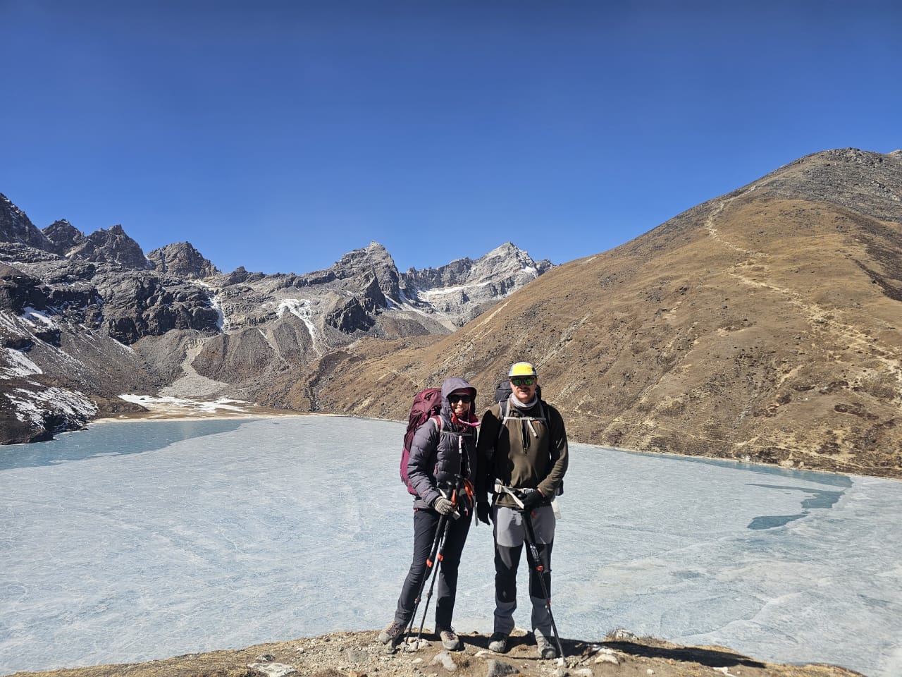
Many hiking and adventure lovers are always searching and asking where the Himalayas are located or where the Everest Base Camp Trek is situated. The Himalayas are located in South and Central Asia, forming a roughly 2,400-kilometer (1,500-mile) arc across five countries: Nepal, India, Bhutan, China (Tibet Autonomous Region), and Pakistan. The range runs northwest to southeast between the Tibetan Plateau and the Indian subcontinent, and it's home to Mount Everest and thirteen other peaks over 8,000 meters — which is why the Himalayas are often called the "Roof of the World."
If you're picturing a map: find the northern edge of India, trace the border where it meets Nepal, Bhutan, and Tibet, and you're looking at the Himalayas. This guide breaks down exactly where the range sits in each of those five countries, what borders it, and what you'd see if you visited each section.
Want to Plan Your Holiday in Nepal?
Make Inquiry Now · Chat on WhatsApp +977 9841044334
Where Are the Himalayas on a Map?
On a physical map of Asia, the Himalayas appear as a continuous white band of snow-capped peaks running along India's entire northern border, cutting through Nepal, curving up into Bhutan, and stretching west into Pakistan and north into China's Tibet Autonomous Region. The nearest major cities to the range are Kathmandu (Nepal), Leh (India), and Lhasa (Tibet) — all useful reference points if you're locating the Himalayas relative to places you already know.
Geologically, the range formed from the collision of the Indian and Eurasian tectonic plates, which is also why it continues to rise a few millimeters every year.
Download the Himalayan Mountains Map (PDF)
Where Are the Himalayas Located, Country by Country
Where the Himalayas Are in Nepal — the Central Core
Nepal holds the central and highest section of the Himalayas — about 75% of the country is mountainous, and this is where the range's most famous peaks and trekking routes sit.
- Home to Mount Everest / Sagarmatha (8,848.86 m), the world's tallest mountain
- Other major peaks located here: Annapurna, Manaslu, Dhaulagiri, Makalu, Lhotse
- Key regions: Everest, Annapurna, Manaslu, Langtang, Mustang, and Kanchenjunga
Because so much of the range sits inside its borders, Nepal is the country most trekkers mean when they picture "where the Himalayas are" — and it's the most accessible section for climbing and trekking.
Where the Himalayas Are in India — Five Northern States
In India, the Himalayas run along the entire northern border, spanning five states:
- Jammu & Kashmir / Ladakh — high-altitude desert and glacier terrain
- Himachal Pradesh — the Pir Panjal and Dhauladhar ranges
- Uttarakhand — sacred peaks like Nanda Devi and major Hindu pilgrimage routes
- Sikkim — home to Kanchenjunga (8,586 m), the world's third-highest mountain
- Arunachal Pradesh — the easternmost point of the Indian Himalayas
This section of the range is where hill stations like Shimla, Manali, Rishikesh, and Gangtok sit, along with some of India's most important pilgrimage sites.
Where the Himalayas Are in China — the Tibetan (Northern) Side
The northern flank of the Himalayas lies inside China's Tibet Autonomous Region, rising directly out of the Tibetan Plateau.
- Tibet averages elevations above 4,500 m, earning its own "Roof of the World" nickname
- The north face of Mount Everest (Chomolungma) is located here
- Key areas: Shigatse, Nyingchi, Ngari, and Mount Kailash, one of the most sacred peaks in the range
This side of the Himalayas is far less visited than Nepal's, but it offers some of the most remote and dramatic views of the range's highest peaks.
Where the Himalayas Are in Bhutan — the Eastern Range
Bhutan sits at the eastern end of the Himalayas, with a landscape as spiritual as it is mountainous.
- Includes Gangkhar Puensum, the highest unclimbed mountain in the world
- High-altitude mountaineering is restricted here to preserve sacred beliefs
- Main regions: Paro, Bumthang, and Haa Valley
Bhutan's stretch of the Himalayas is quieter than Nepal's, with far fewer trekkers and a more meditative pace.
Where the Himalayas Are in Pakistan — the Western Edge
Pakistan holds the westernmost section of the range, concentrated in Gilgit-Baltistan, where the Himalayas merge into the neighboring Karakoram Range.
- Home to Nanga Parbat (8,126 m), the ninth-highest peak in the world
- Known for extreme terrain and some of the most technically demanding climbs on Earth
This section is often overshadowed by the adjacent Karakoram, but it's a genuine, and especially rugged, part of the Himalayan system.
Where Else the Himalayas' Influence Extends
Beyond the five core countries, the range's geological reach extends further:
- Afghanistan — connected via the Hindu Kush
- Bangladesh — the eastern foothills descend into Sylhet
- Myanmar — linked through the Patkai Hills
- Tajikistan — the Pamir Mountains, part of the same orogenic belt
These areas aren't part of the central Himalayan range, but they're geologically tied to it.
Which Country Has the Most of the Himalayas?
Nepal has the largest share of the Himalayas by both area and prominence. It contains 8 of the world's 14 peaks above 8,000 meters and the majority of the range's best-known trekking routes:
| Trek Name | Elevation | Distance | Cost (USD) |
|---|---|---|---|
| Everest Base Camp Trek | 5,545 m / 18,192 ft | 130 km / 81 mi | $1,200 – $1,800 |
| Annapurna Base Camp Trek | 4,130 m / 13,550 ft | 115 km / 71 mi | $800 – $1,200 |
| Annapurna Circuit Trek | 5,416 m / 17,769 ft | 160–230 km / 100–143 mi | $1,200 – $1,900 |
| Manaslu Circuit Trek | 5,160 m / 16,929 ft | 177 km / 110 mi | $1,200 – $1,800 |
| Kanchenjunga Base Camp Trek | 5,143 m / 16,873 ft | 200 km / 124 mi | $2,000 – $3,500 |
| Mardi Himal Trek | 4,500 m / 14,764 ft | 40–50 km / 25–31 mi | $500 – $900 |
| Upper Mustang Trek | 3,810 m / 12,500 ft | 125 km / 78 mi | $1,800 – $3,000 |
| Everest Three Passes Trek | 5,545 m / 18,192 ft | 166 km / 103 mi | $1,500 – $2,200 |
| Nar Phu Valley Trek | 5,240 m / 17,192 ft | 90–100 km / 56–62 mi | $1,200 – $1,800 |
| Langtang Valley Trek | 4,984 m / 16,352 ft | 65–70 km / 40–43 mi | $700 – $1,200 |
Where Are the Himalayas Located in Asia, Broadly?
Across Asia, the Himalayas run west to east through Pakistan, India, Nepal, Bhutan, and Tibet (China). Their position between the Indian subcontinent and the Tibetan Plateau makes them a major driver of South Asia's monsoon system and the source of several of the region's largest rivers, including the Indus, Ganges, and Brahmaputra.
How High Are the Himalayas, and Where Are the Tallest Peaks?
The tallest peaks in the Himalayas sit on or near the Nepal–China (Tibet) border and the Nepal–India border:
- Mount Everest — 8,848.86 m (Nepal/Tibet border)
- Kanchenjunga — 8,586 m (Nepal/India border)
- Lhotse — 8,516 m (Nepal/Tibet border)
- Makalu — 8,485 m (Nepal/Tibet border)
- Dhaulagiri — 8,167 m (Nepal)
Where Do the Three Major Himalayan Ranges Sit?
The Himalayas aren't a single ridge — they're made up of three parallel sub-ranges, running roughly north to south:
- Greater Himalayas (Himadri) — the northernmost and highest band, containing Everest and Kanchenjunga
- Lesser Himalayas (Himachal) — the middle band of mid-altitude valleys and hill stations
- Outer Himalayas (Shiwalik) — the southernmost and lowest band, forming the foothills
Final Answer: Where Are the Himalayas Located?
The Himalayas are located in South and Central Asia, spanning Nepal, India, Bhutan, China, and Pakistan, and stretching roughly 2,400 km from the Indus River in the west to the Brahmaputra River in the east. Nepal holds the largest and highest share of the range, including Mount Everest, which is why it remains the most popular country for experiencing the Himalayas firsthand — whether that's trekking, climbing, or simply taking in the view.







Add Your Comment